Back فوتالاوفكين (بحيرة) Arabic Lago Futalaufquen CEB Λίμνη Φουταλάουφκεν Greek Lago Futalaufquen Spanish Lac Futalaufquen French Futalaufquen-tó Hungarian Futalaufkenas Lithuanian Lago Futalaufquen Swedish
| Futalaufquen Lake | |
|---|---|
 | |
| Location | Futaleufú Department, Chubut Province |
| Coordinates | 42°49′43″S 71°38′17″W / 42.82861°S 71.63806°W |
| Type | Glacial lake |
| Primary inflows | Arrayanes River |
| Primary outflows | Lake Kruger, Frey River |
| Catchment area | 2,920 km2 (1,130 sq mi) |
| Basin countries | Argentina |
| Max. length | 16 kilometres (9.9 mi) |
| Max. width | 2.5 kilometres (1.6 mi) |
| Surface area | 44.6 square kilometres (11,000 acres) |
| Average depth | 101 m (331 ft) |
| Max. depth | 168 m (551 ft) |
| Water volume | 4.51 cubic kilometres (3,660,000 acre⋅ft) |
| Residence time | .94 years |
| Shore length1 | 72.5 km (45.0 mi) |
| Surface elevation | 518 metres (1,699 ft) |
| References | [1] |
| 1 Shore length is not a well-defined measure. | |
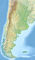
Futalaufquen Lake (Lago Futalaufquen) is a large lake in Chubut Province, Argentina. Futalaufquen Lake is in the chain of lakes of the Futaleufú River system of Argentina which via Yelcho Lake and the Yelcho River flows into the Pacific Ocean in Chile. Located in the Andes, Lake Futalaufquen is three-lobed, of glacial origin, and occupies narrow valleys between glaciated peaks. It is located in the Andes within Los Alerces National Park. The name comes from the Mapuche language. "Futa" means great, and "laufquen" means lake.
A highway runs along the eastern arm of the lake. Tourist facilities and the National Park headquarters and Futalaufquen village are there. Fishing for trout is popular in the lake.
- ^ "Lake: Futalaufquen, Sistema Nacional de Informacion Hidrica,https://web.archive.org/web/20110902232811/http://www.hidricosargentina.gov.ar/EIndice-Futalaufquen.html, accessed 30 Jan 2018
